Program Spotlight: Geographic Information Systems (GIS)
May 18, 2023
Understand the world we live in and help others see it too. Assiniboine’s full-time, on-campus, eight-month Geographic Information Systems (GIS) advanced diploma complements virtually every career because literally every industry around the globe uses this technology. No really, they do—stay with us, and we’ll explain.
At its core, GIS is the science of creating, managing, analyzing and mapping data. It’s the technology equivalent of having spatial awareness, essentially a spacial system designed to visually represent scads and scads of information that would be otherwise too overwhelming to digest in its original form.
It’s a 150 year-old-practice that can trace its origins back to a cholera outbreak in 1854. A physician in London, England started mapping out the outbreak to try and make sense of why so many people were becoming ill. He not only mapped the disease, but also the roads, property boundaries and water lines. Once these features were added into the mix, he saw something remarkable: cholera cases were only along a single water line. Without this visual representation, the physician would likely never have correlated cholera with its mode of transmission: water.
In today’s technology-driven world, we can take this 1854 history lesson, but use incredible software to digest even more data points and create in-depth visuals. GIS helps people understand patterns, relationships and geographic context so they can solve complex problems, communicate more effectively, plan more efficiently and know the “lay of the land” they’re working within.
For instance, businesses use GIS to determine new store locations, profile customers and determine purchasing trends. Governments use GIS to track crime, forecast flood waters or show the spread of disease. Agriculture uses GIS to manage precision farming, complete soil mapping and determine crop productivity. Every single day, millions of people use GIS when they open the map app on their phone to get from point A to point B, find the nearest gas station or see what restaurant is open.
Careers in GIS are in-demand and well-paying. If you have the curiosity to keep asking questions and really dig into a problem; if you like communicating a lot of complex information to others in a digestible way; if you innately “see” things in a spatial manner, you should consider adding a GIS advanced diploma to your resume.
It’s an exciting time to be trained in GIS. Assiniboine’s program will teach you how use the latest technologies and apply them in a way that is connected to the industry you wish to pursue after graduation. GIS helps funnel your curiosity about the world we live in and puts you in a great position to explore it. Get a niche skillset that will set you apart. To learn more about the Geographic Information Systems program, visit assiniboine.net/gis or attend a free, online information session. Go to assiniboine.net/infosession to register and to see upcoming dates and times.
Related Articles
Parkland Campus announces construction skills training for learners of all experience levels

Important Update: Former student email services are discontinued as of October 2026

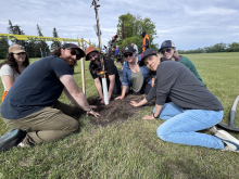
Assiniboine marks 65 years with 65 legacy trees at North Hill campus